The India module
India, sheet by sheet, state by state.
A political sheet, a shaded-relief physical sheet and every State and UT down to its districts. Hold a river, peak or range to open its study card.
- States and UTs with districts
- 36
- curated physical features
- 200+
- river study cards
- 75
- peaks · long ranges
- 30 · 8
Sheet 1 · Political
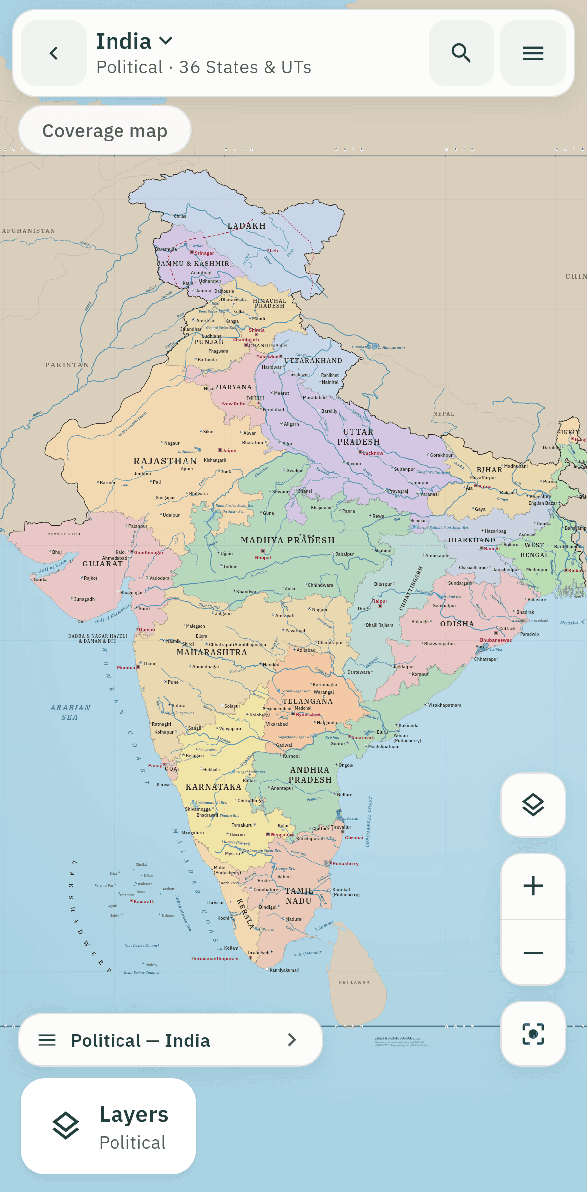
The political sheet
All 36 States and UTs, neighbouring countries, major rivers, seas, coasts and cities, lettered so that no two names collide. Turn on the coverage map and the states you have learned colour in.
Sheet 2 · Physical
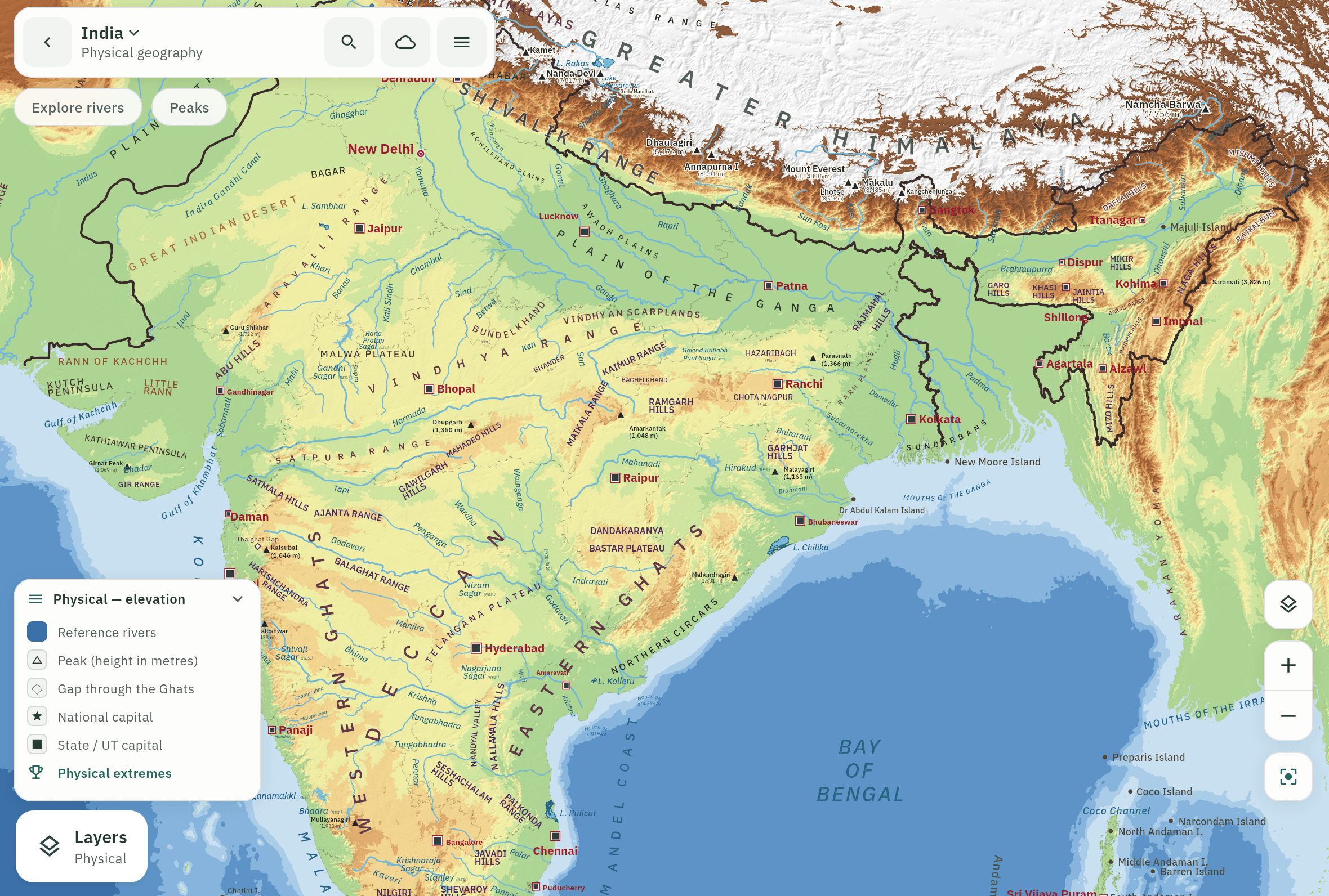
The physical sheet
Shaded relief with over 200 curated features: rivers, hills, peaks, plateaus, islands and seas. Range names run in spaced capitals along the ridge line, the way Western Ghats does, and coast names follow the shore.
Drill-down
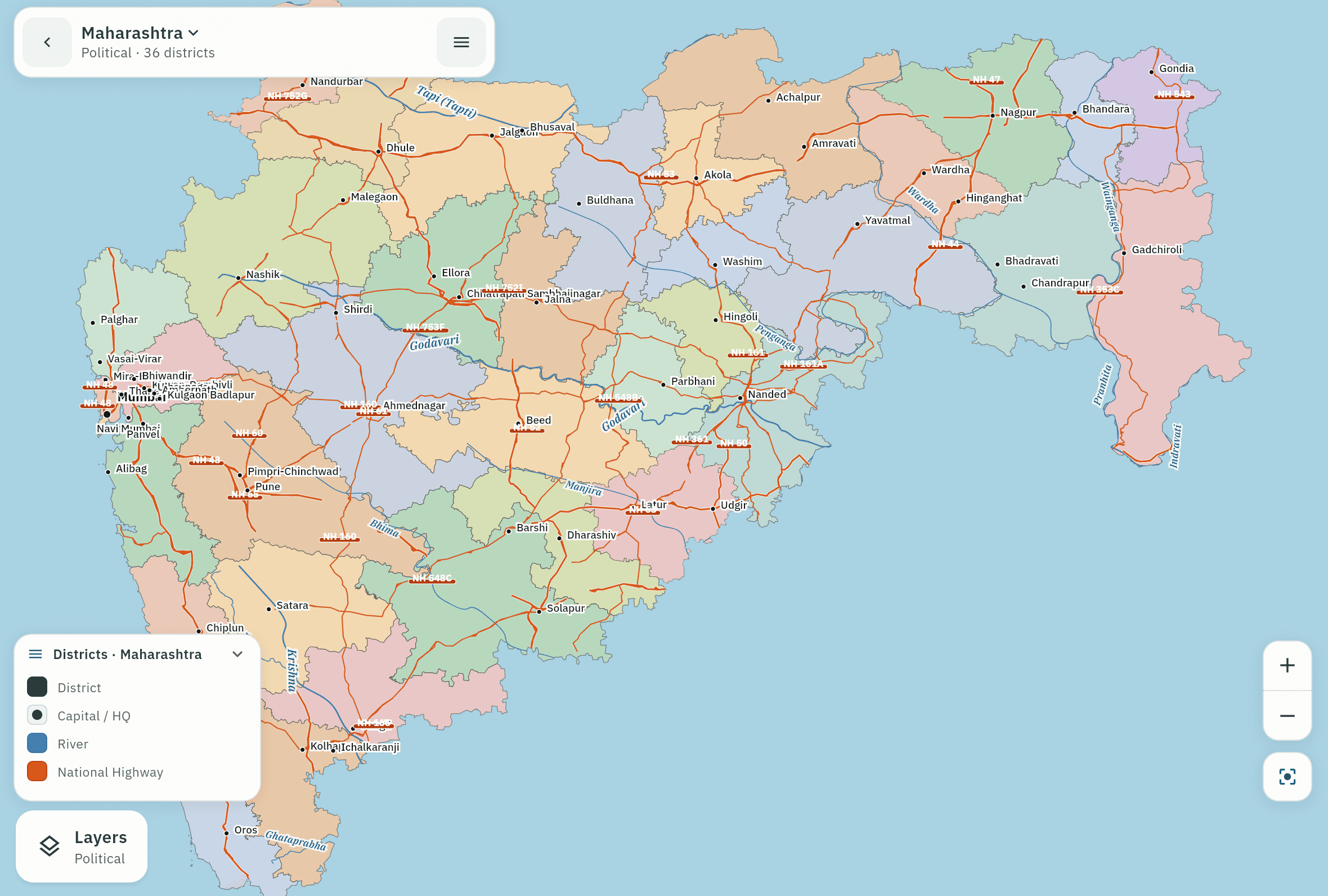
Tap a state to open it
Districts, capital, cities, rivers, highways and rail, with a fact card for the state itself. World, India and State, one tap deeper each time.
Explorers
Hold a river. Learn its whole course.
On the physical sheet, press and hold any of 75 rivers, from the Ganga to the Kaveri, for two seconds. The same works for 30 peaks and 8 long ranges. Try it on the map below.
- 1Hold on the river line.
- 2The ring fills. Two seconds, so a stray touch never opens it.
- 3The study card opens with source, course, dams and places.
Press and hold the river for two seconds.
River explorer
Ganga
Ganges · National River of India
≈ 2,525
km · total length
- Origin
- Gangotri Glacier (Gaumukh), UttarakhandNamed Ganga below Devprayag, where the Bhagirathi meets the Alaknanda
- Outlet
- Bay of BengalThrough the Ganga–Brahmaputra (Sundarbans) delta
- Main course
- Uttarakhand → Uttar Pradesh → Bihar → Jharkhand → West Bengal; continues in Bangladesh as the Padma
- Dams
- Tehri Dam · Farakka Barrage
Climate overlays
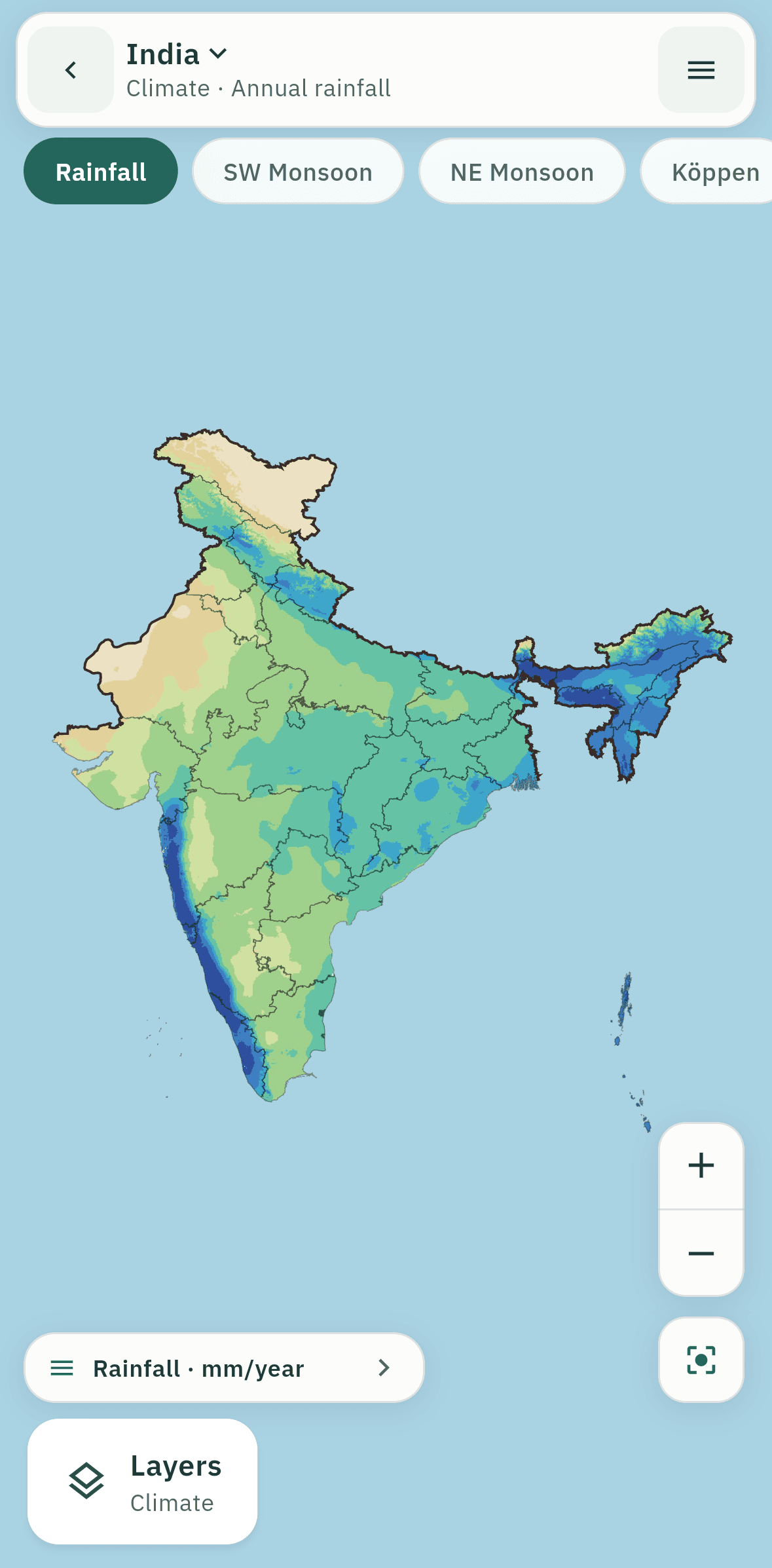
India’s climate, layered on the map
Switch on Köppen climate regions, rainfall or the monsoon over the same sheet you’ve been studying.
What’s covered
- 36 States/UTs, neighbours, seas, coasts, cities
- District drill-down with highways and rail
- Shaded relief and 200+ physical features
- 75 rivers · 30 peaks · 8 long ranges
- Köppen, rainfall and monsoon overlays
Boundary statement
India is shown with its full extent as per the Survey of India, including PoK and Aksai Chin. Automated tests enforce it on every build.
Sources and licences